The Project
The Forest Hill Divide
Placer County, California — a historic drift-mining district on the ancestral American River channel system.
Site footage of the Forest Hill Divide property, Placer County, CA.
Six mines, four channels, one continuous story.
The property covers a portion of Sections 22 through 27 and 34 through 36, Township 14 North, Range 10 East, Mount Diablo Meridian. Drift mining here exploited deeply buried Tertiary river channels — ancestral tributaries of the American River — preserved beneath volcanic and sedimentary cover. The Baltimore, New Hope, Mayflower, Excelsior, Live Oak, and Paragon mines each targeted these channels from different points along their length.
The Mayflower Mine’s principal production ran from about 1888 to 1899, yielding roughly $1.6 million in gold at period-of-production values. Between 1915 and 1918 alone, the Excelsior Mining Company reported combined production of about $253,817 from the Independent, New Jersey, and Jenny Lind workings. The Paragon lead is recorded as producing $900,000 from its main tunnel, with the Orono channel contributing a further $75,000. These figures come from historic State Mineralogist reports and period production records, not modern estimates.
In the field.
Ownership has walked the property directly — examining exposed outcrops, reviewing historic maps on-site against the physical terrain, and recovering gold during a site visit.
Gold recovered during a site visit to the property. Shown for illustrative purposes only — not indicative of resource grade or extent.
How we mapped it.
The base map was constructed from record surveys and parcel maps on file with the Placer County Recorder. Historic drift mine and channel locations were georeferenced from three primary sources: the 1890 Map of the Forest Hill Divide, prepared for the Tenth Annual Report of the State Mineralogist by Ross E. Browne; and the 1929 and 1931 maps by Edw. C. Uren, M.E., covering the Baltimore and Mayflower channels. Property boundaries and title exceptions were taken from a preliminary title report by WFG National Title Insurance Company.
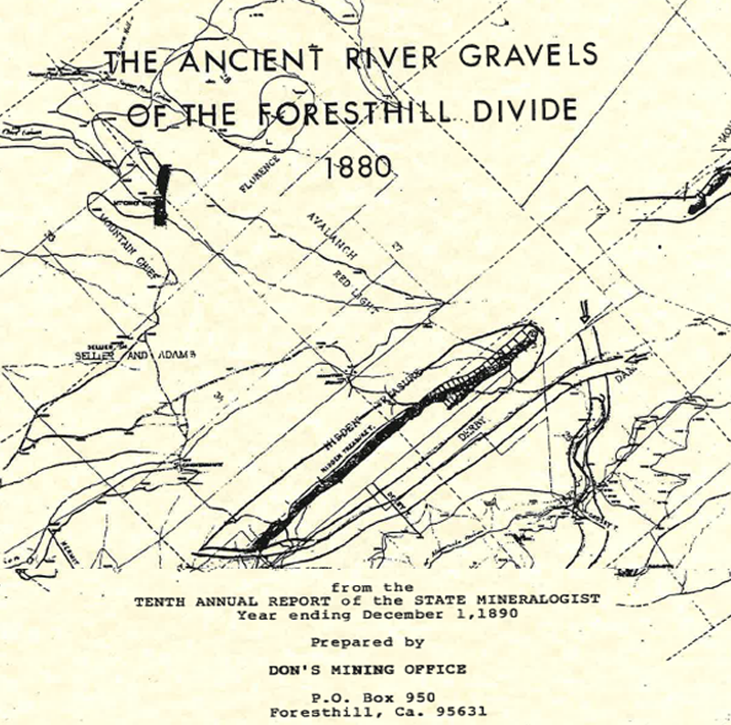
A historic claim map showing the Hidden Treasure, Derby, and adjoining claims within the district.
Historic production figures are drawn from period State Mineralogist reports and company records and have not been independently re-verified. All resource figures referenced across this site are Inferred Mineral Resource estimates (Yuba Industries Technical Report, March 2026); no modern drilling, sampling, or independent Qualified Person report has been completed. This page is for informational purposes only and is not an offer or solicitation of securities.